Sunday, April 26, 2009

Geocaching Stats Update

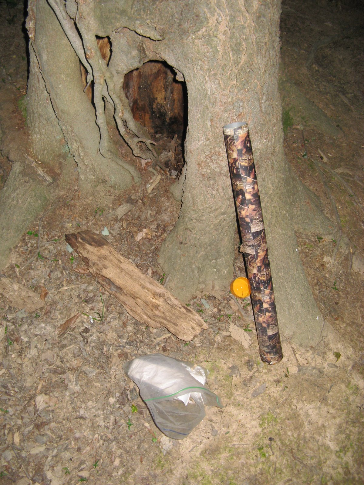
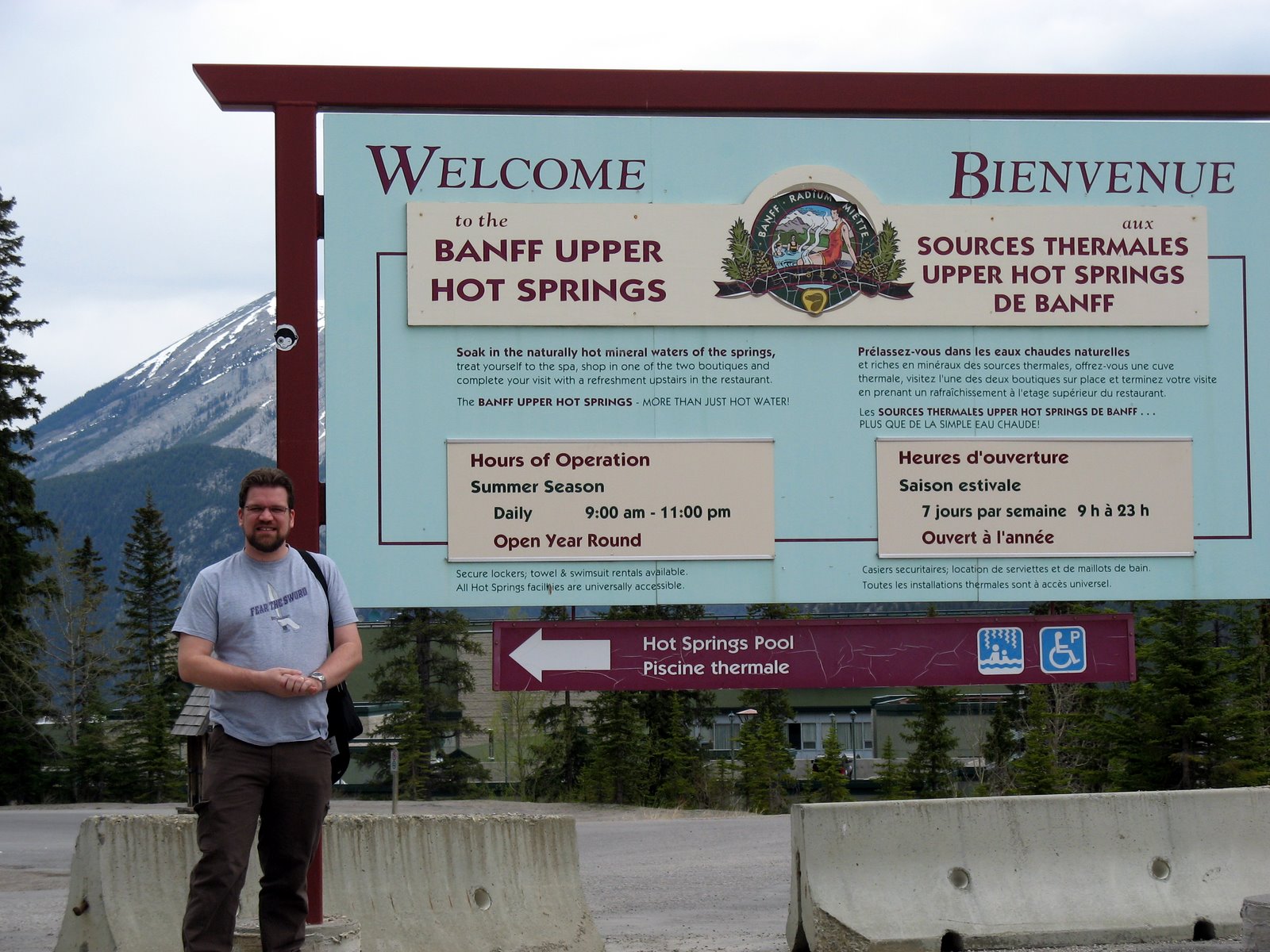
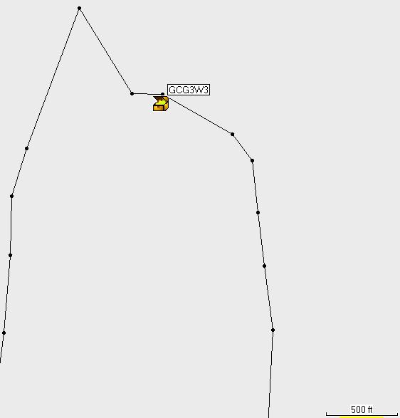
It's been since last June since I posted a full-fledged geocaching stats update. At the time, I had found 61 caches; now I have found...78. Since last June (after the update), I have only found one physical cache. That was...yesterday. There's one on the bike trail mentioned in a previous post, so I decided to grab it. It wasn't too urban or too woodsy to touch on any of the things that had bothered me about physical geocaches. Today, I did an earthcache here in Cologne, Germany.

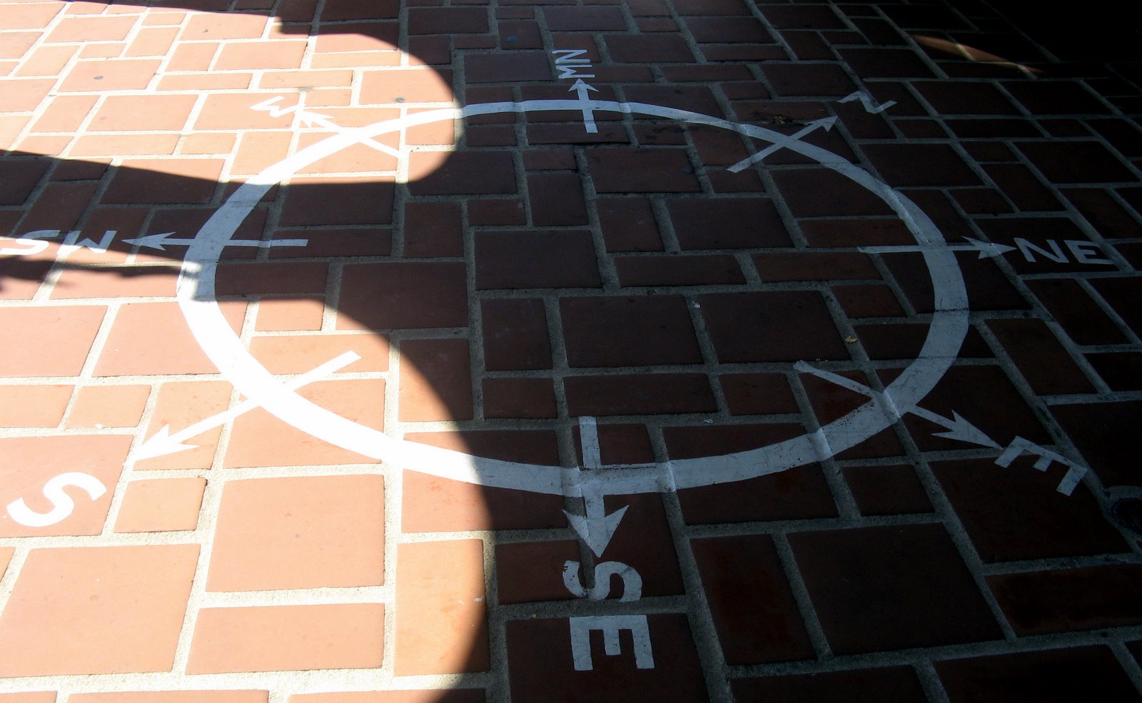
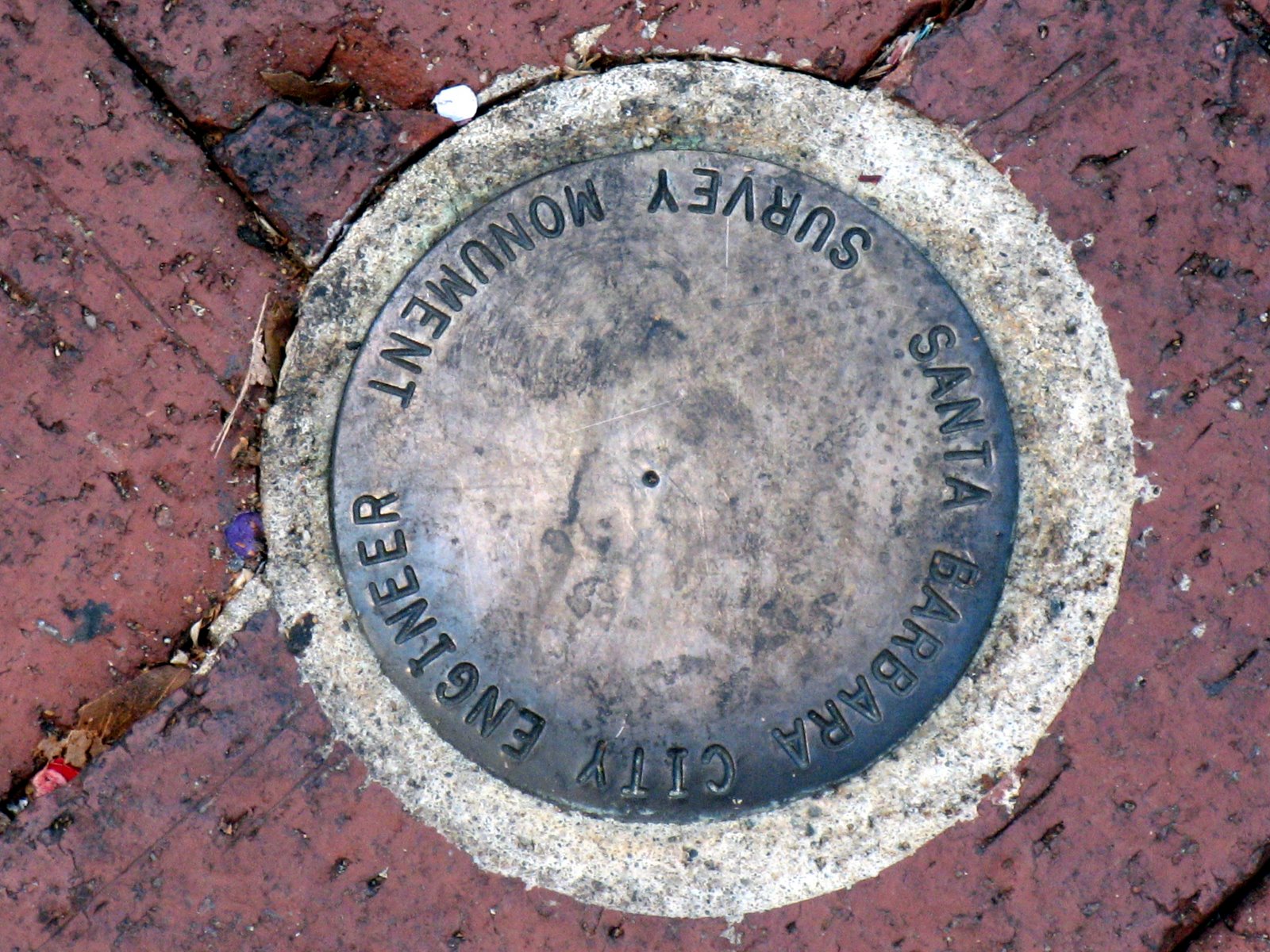
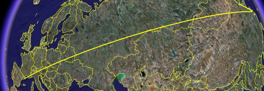
Sadly, some of the requirements lead to some pretty stupid pictures. Anyway, that brings my total "cache-to-cache" distance to 86743.95 miles. That means, on average, I've traveled over 1,100 miles between each cache. I'll bring that average down later in this week with a virtual cache a stone's throw from the cathedral. (I misunderstood the instructions today and have to take a new picture).


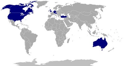
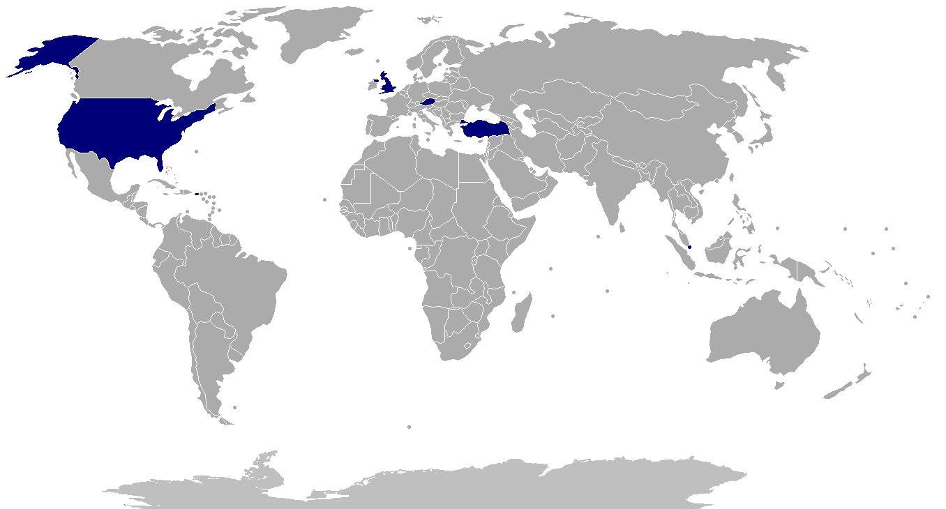
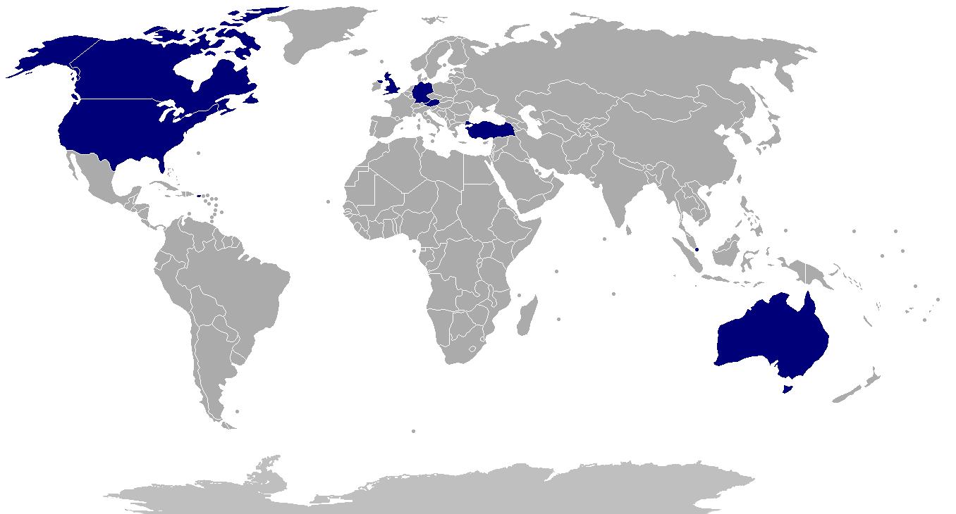
I'm now up to caches in 9 countries, having added Australia and Germany since last June.

I'm still enjoying waymarking more, but the ability to generate stats in geocaching is way more advanced.

Labels:

Tuesday, August 19, 2008

Waymarking Santa Barbara


Last year, I spent my free afternoon at this conference in Santa Barbara geocaching. This year, it was time for some waymarking. I was particularly interested in increasing my category count. Yesterday, I told you I was at 73; now it's 95. Here is an assortment of pictures from an afternoon of waymarking. Some are interesting; some are mundane -- like the waymarking categories. Annoyingly, some require me to put my GPS receiver in the picture in order to get credit. Enjoy.


Posted by Picasa

Labels: , ,

Monday, August 18, 2008

Waymarking Bingo

 
Posted by Picasa


I've been doing more waymarking than geocaching lately. I have a couple of main motivations for this -- one, if I'm in an urban/suburban area, waymarking doesn't require me to dig around suspiciously. Two, if I have a choice of areas, I lean towards the area without ticks.

A secondary motivation, however, is waymarking bingo. For each category of waymarks (e.g., pyramids, sushi restaurants, "you are here" signs) that I log, I get an icon on my user page. Above, you can see rows 19-37 of my user page (the current page is here). As of this morning, I have 73 out of a possible 752 categories.

Some waymarkers have introduced the concept of "waymarking bingo", which they defined as 20 icons in a row, column or diagonal. Very few waymarkers have achieved this. I feel like I've been doing a lot of waymarking, and the best I have done is 4 in a row (row 33). It'll probably be a long time before I get a bingo. You might think row 33 is my most promising row, since I already have 4 in a row. But row 33 contains such tricky categories as Abandoned Air Force Radar Sites, Martello Towers and Holy Wells. There are 13 existing waymarks worldwide in the first category, 14 in the second, and 29 in the third. I don't expect to be in the neighborhood of them any time soon.

I can always wait for someone to create a more convenient waymark in one of these categories or even - gasp - do the research and create one myself. For categories like KFC and 7-11, that's easy...and then I get to put them on my "ignore" list, since I'm not really interested in seeing more than one. For the above categories, that could be a little trickier.

Truthfully, I'm more interested right now in filling out the grid as much as possible than in getting "bingo". It's interesting to hunt down the rarer icons. When I was at LAX last night, I noticed I was near an example of Googie architecture. Since there aren't any examples near home, I decided to find that one. It turned out to be the most expensive waymark find yet, but that's a tale for another post...

Labels: ,

Monday, August 11, 2008

Round and Round


On my break from a conference in DC today, I walked to a virtual geocache that required me to walk a labyrinth carved into the ground and follow a very specific set of instructions.
Right as you enter the labyrinth, you'll notice the only place where the lines of the labyrinth cross. As you round the labyrinth, keep track of how many times you go past that point on the way to the center. (In other words, if there was a line drawn on the ground from that point to the southwest edge of the labyrinth, how many times would you cross that line on your journey to the center.)
I wasn't sure I followed the instructions correctly, so I took a picture, came home and re-traced my steps. (I had.)

Then I noticed that the cache "owner" -- who is the only one who could prevent me from logging the cache due to a wrong answer -- hasn't logged on in a year. So I didn't really need to do this. So it doesn't go to waste, I share it with you here.
Posted by Picasa

Labels:

Thursday, July 24, 2008

2 California Virtuals


After I got off work today, we went down into La Jolla and visited two virtual geocaches. The first centered on this strange monument. The key to it is apparently here; it is a way of circumventing a ban on explicit memorials, I guess.

The second one involved reading an inscription off a bench. We beat a hasty retreat when the guy on the bench started talking to us of aliens and other such things.
Posted by Picasa


In my goal of getting all virtuals (and similar) within 70 miles of home, I briefly got the number down to 121 with a visit to "Jug Bridge" in Frederick earlier this month, but someone posted a new earthcache in Calvert County, so I'm back up to 122.

Labels:

Monday, June 30, 2008

Bronze Earthcache Master

I first mentioned earthcaches in the context of my trip to Banff last month. Run by the Geological Society of America, the earthcache program encourages people to visit sites of geological significance and learn something about them. I visited three in the Banff area.

Soon afterwards, I learned about the Earthcache Masters program. By visiting three earthcaches in two states or countries, I could qualify as a "Bronze Earthcache Master". Since all of my finds were in Canada, I needed to visit one some place else. So after Christina and I visited one near Laurel a week or two ago, I sent my information in. Today in the mail I received my very own bronze earthcache master pin.

To reach silver, I need to visit a couple more and involve at least one more state/country. That's the easy part. The hard part is that I would have to place an earthcache myself. That would involve finding an interesting geological feature, writing it up, and perhaps most challengingly, getting permission from the park or wherever it ends up. I haven't decided whether I'm up for that; I guess I'll try visiting the next two first and see how that goes.

Labels:

Tuesday, June 24, 2008

Geocaching: Maryland County Map


Well, the It's Not About the Numbers site is improving, so I can post this new Maryland county map. I'm up to 8 counties with the addition of Charles. Also, I've bumped my PG County total into the double digits, and I now have at least two finds in each of the surrounding counties.

I suspect the far reaches of the state -- the Western Panhandle, the parts of the Eastern Shore not right across the bridge -- will require coordination with special trips. In particular, the western counties might be do-able on the way to ski at Wisp next winter.

Labels:

Saturday, June 21, 2008

Geocaching Update: Virtuals and Charles County

Yesterday and today I made progress on two of my geocaching goals. First, I knocked the number of remaining caches in my self-imposed "virtual challenge" down from 125 to 122. Second, I increased my number of Maryland counties with cache finds by 1, to 8 (out of 24*).
 
Friday evening, Christina and I went to the Fairland Regional Park, near Laurel, where a display on stormwater management served as an earthcache. It was fun to walk around. We made an abortive attempt to find a physical cache as well, but found 4 deer instead.
 
Today, I went driving around to do some caching while Christina hung out with my Aunt Sally. My main goal was Charles County, but along the way I decided to visit a virtual cache in Prince George's County. Along the way to that, I found myself driving through DC near another virtual -- a giant chair.
 

After the giant chair, it was time to visit National Harbor, PG County's new billion-dollar waterfront development. A statue of a giant buried in sand had recently been moved from DC. Since the statue was a virtual cache, the cache moved, too.
 

After that, I drove down to Charles County. Pictured is the first cache I found, cleverly disguised as a birdhouse. I found a second for good measure before returning home.
Posted by Picasa


Unfortunately, the site I use to generate all those neat stats is having technical problems, so it may be a while before I post them again. I donated $5 and sent some words of encouragement. I also posted in the geocaching forums inviting others to do the same, so hopefully that will do some good.

*Including Baltimore City as a county, for these purposes.

Labels:

Tuesday, June 17, 2008

Geocaching: Virtual Challenge

As previously mentioned, I've been enjoying doing virtual caches lately. As also previously mentioned, no new virtual caches have been allowed since 2005. I decided to combine these observations by trying to do all virtual caches within 70 miles of home. Since nobody can create virtual caches any more, I don't have to worry about new ones popping up faster than I find them.

To throw a wrinkle into the plan, I am also allowing two types of virtual-like caches: earthcaches and webcame caches. Webcam caches are ones where you go to the coordinates and then get somebody in front of a compute to find you on a particular Internet-connected camera. They save that picture, which is your proof of having visited that "cache". I have never tried one of these, but I figure they fall into the spirit of virtual caches.

I did three earthcaches in Canada last month. Unlike virtual caches or webcam caches, people are allowed to create new ones. On the other hand, there are only 26 on my list, so I don't feel like I'm in much danger that they'll be created too quickly for me to handle.

Why 70 miles? Two reasons. One is that I'm about 62 miles from Gettysburg, so that distance is far enough to include a trip up there to get the virtual caches there. The other reason is that right now there are 125 left to do within 70 miles, so it makes a nice number from which to begin my countdown.

I thought I'd post about this goal, so I could give updates in the future. I'll probably get started this weekend. 27 of the 28 closest caches on my list are in DC, so that makes a good way to get a bunch at a time. I've plotted a walk around the western section of the Mall that should get 12. On the other hand, some of the other caches are fairly remote....I'd be surprised if I finished within a year.

Labels:

Sunday, June 08, 2008

Sweden?!

 
I dropped off my Free State Mover #3 geocoin in Banff last month with the mission "to return to the United States, specifically Maryland, specifically inside the Capital Beltway."

I included with the coin a note explaining the mission. I figured it would be easier to get this one back than the ones I had dropped off in England and Austria. So you can imagine my surprise this morning when I discovered the coin had ended up in Sweden. Sigh.
Posted by Picasa

Labels:

Wednesday, June 04, 2008

Cache Stats Fever

Since I last posted about my geocaching activities, I've been on somewhat of a tear, by my standards, finding 9 caches in a span of 4 days. I enjoyed finding 2 virtual caches in DC over Memorial Day weekend, so took the Metro into town again and found 7 more last weekend.
One of them involved posing with a statue of John Pershing.

Then, on Monday, I got an alert about a cache placed 0.2 miles from my "home coordinates". It was a very small cache (a "nano"), which I don't find too interesting, but I stopped by on the way home on the chance that I might be "first to find". I was a couple of minutes too late, but I watched someone else find it (which was actually preferable, as I didn't have to find the silly thing hidden in a stop sign).


Yesterday, I was at a conference in Gaithersburg, so between the conference and a reception, I headed out to another virtual cache. This one was based on Coffin Rock, from the Blair Witch Project movie. I dunno, never saw it, but it was an interesting 1/4-mile hike to the rock.

All this is by way of saying I've been pumping up my statistics and am eager to update them. One motivation for finding 7 in a day over the weekend is that it replaced a day last August as my "best day"; I only found 3 then, and it didn't seem particularly great.


Instead of maps, this time you're getting a much more compact representation of where I've been caching. Note the additions of Canada and DC with multiple finds each. The number of counties in Maryland is off by 1 because it lists the stop-sign cache as "uncalculated", rather than Prince George's County. I'll have to send an e-mail about that...hmm, it's since cleared up on the site.


Looking at the chart of terrain and difficulty ratings made me realize how many of the ones I've been doing have been clustered in the upper left. One reason for doing the stop-sign nano was to get a difficulty higher than 2.5. I may select caches to get specific terrain/difficulty combos in the future.
 
Posted by Picasa

Labels:

Thursday, May 29, 2008

Caching After Work

 
I decided to take advantage of the nice weather and long day to do some geocaching after work. I had been holding on to a travel bug for three months, which is about two-and-half months longer than is polite. So I decided to head out to a cache I had my eye on near Lake Artemesia, an artificial lake a couple of miles from home. I walked partway around the lake, then veered off on a trail towards the cache. Unfortunately, it was the wrong trail, and I soon found myself about 300 feet away from the cache, on the wrong side of a river. You can see my false start on this screen capture from Google Earth -- I now figured out how to put my GPS tracks in that, which I think is much cooler than the mapping program I had been using.
 

I backtracked (it would have been helpful to use Google Earth before caching) and headed up the correct trail, but it was getting dark. I realize the following details (and accompanying picture) represent a geocaching spoiler, but I don't think any of my reader will actually be looking for this cache. I wanted to give people an idea of what's involved in hunting these things. The clue said "hollow tree", and sure enough, I found a hollow tree about 30 or so feet from where the cache was supposed to be. Between the inaccuracy in my GPS readings and the inaccuracy in the readings of whoever placed the cache, the tree seemed a likely candidate. But I looked inside the hollow and saw nothing cache-like, so I went on. My GPS receiver, however, told me I was getting farther away. So I went back to the tree. This time I used the light on the keychain Christina gave me. Sure enough, there was a stick-like thing in the hollow that looked un-natural. I poked it first to make sure it wasn't something weird. When it didn't respond, I pulled out the camouflaged tube (pictured) that represented the cache. I thought this was a fairly tricky find...and this only rated '2' out of '5' on the difficulty scale. I can see why I may have missed some caches in the past. This did not look like the Tupperware container I was expecting to find. I suppose now I'll have a better idea of what to look for in future cache finds. I was barely able to get the travel bug (a shell with an tag attached) inside the tube, and I made it back to my car about a minute after sundown. According to the GPS receiver, almost exactly and hour and 2.4 miles of walking. Not bad.

Posted by Picasa

Labels:

Wednesday, May 21, 2008

Earthcaching Banff

Since Christina and I had previously visited Banff, I figured I was under no pressure to "see the sights" yesterday on my free afternoon. So I decided to do some geocaching, which led me to sights I would not have ordinarily seen.

I actually found one geocache on Sunday -- about 50 feet from the conference site. After failing to release Free State Mover #3 in Puerto Rico, Malaysia, Singapore, England and Turkey, I finally set it free. It should have an easier task of getting back to Maryland than its European predecessors.
 
In a previous post, I claimed that "virtual" caches had been eliminated. That's not entirely true -- there is a special type remaining: the Earthcache. Unlike the old virtual caches, which could be of anything the submitter found interesting, Earthcaches have to teach something about geoscience, and it has to be approved by the Geological Society of America. This approach seems like a good compromise -- it allows caches in sensitive areas where you can't put a physical cache, but it limits their proliferation to educational sites.

The first cache I visited yesterday was, in fact, an Earthcache. It was the Banff Upper Hot Springs. Christina and I had visited there, so I didn't feel a need to bathe in the springs this time. Good thing -- paramedics were treating a woman, and the line of people waiting to get in the pool was backing up.
 
My second cache was another Earthcache and another set of hot springs. As it turns out, this set of hot springs is no longer open for bathing, but it is an important place in Canadian history. When trying to figure out what to do with the springs, the Canadian government decided that they should be publicly owned. This decision eventual led to the establishment of Canada's first national park.
 
Looking for another cache, I was led to my third Earthcache of the day, Limestone Hoodoos in Banff. A hoodoo is a particular geological formation (pictured) created by uneven erosion of sediment. After taking some pictures, I headed out down the Hoodoo Trail. A sign said that walk was 1 km and about half an hour. I turned around when I reached 1.55 km (as the crow flies) -- I'm not sure what the 1 km represented.
 
I decided the day of geocaching wouldn't be complete without finding a physical cache, so I headed to Jumpin' Johnson Lake. The cache was about one-quarter of the way around the lake, but I continued to walk the whole way around. While walking, I was listening to a geocaching podcast where they had a call from a listener who had reached 500 caches about two months of caching. Given that yesterday's haul of 4 matched my all-time high, I am clearly in a different category from people like that. (I'm at 49 total after 14 months.) But I'd rather use geocaching as a jumping off point -- I wouldn't have come to Johnson Lake without it. As a result, I got some nice scenery and some much-needed exercise.

I almost got more exercise than I bargained for. As I had almost completed my circumnavigation of the lake, the trail dead-ended at the lake. I was afraid I was going to have to go all the way back around. First, however, I tried doubling back and seeing if I had taken the wrong fork. As I got on a more promising path, I noticed a rushing steam that would block a walk around the lake. Fortunately, a few minutes later, I saw the bridge that would allow me to complete my hike.

Posted by Picasa

Labels: ,

Sunday, May 11, 2008

Free State Mover #1: Back to England


Despite my fears, the Free State Mover #1 geocoin I dropped off in Bristol last September was not lost in Wales. After a three month stay in a cache there, it moved across the border to a cache in England. Still no progress towards Maryland, but it's better than being lost.

By coincidence, Christina and I were about 10 miles away in 2006, so I have some idea what the area's like.

Labels:

Sunday, May 04, 2008

Shanghai and Barcelona


Shanghai and Barcelona -- places I went in December 2006 and May 2007, respectively. Places my geocoin Free State Generic #2 went last month. When I last updated you, it had headed from Virginia to Beijing. From Beijing, it went to Shanghai. From there, it took an unexpected trip to Barcelona. It looks like the person who transported it logged it into a cache there just to record its travel, since he immediately logged it out again. It'll be interesting to see where this one ends up next.

Labels:

Tuesday, April 29, 2008

Istanbul Virtual

When I was in Istanbul a couple of weeks ago, I didn't expect to do any geocaching. First, there aren't any "normal" caches within 10 miles of the city center. Second, Turkey wasn't a country where I felt super-comfortable rummaging around for hidden containers.

The only two caches near where I was staying were virtual caches, which as I've mentioned before is a now-obsolete form of a cache that contains no physical container. I had no expectation of finding either one -- one was on the Asian side of Istanbul, and the other was at a bridge connecting the two sides. Since I had no plans to go to Asia, how could I find them?

As it turns out, our conference excursion included a cruise on the Bosphorous. I turned on my GPS, and was wondering how close we'd get to the cache at the bridge. After all, it was a one-hour cruise, and I knew we had to turn around at some point.


As you can see from the tracking, I got pretty darn close! In fact, by the standards of virtual caches, that counts as a find! It's kind of neat that the cache essentially was our turn-around point.

I snapped this picture of myself at the cache location.


This find does nice things for my countries-cached-in map. (Click for the full-size version, where you can see I get credit for Singapore and Puerto Rico.)


Unfortunately, finding a virtual cache means I don't have a chance to drop off any geocoins. I plan to take care of that next month in Canada.

Labels: ,

Friday, April 11, 2008

Off to China


No, not me. It's another one of my geocoins. I released Free State Generic #1 and #2 just to have something to release. Free State Generic #1 is, appropriately, trekking around Maryland. Free State Generic #2, for some reason, I released in Virginia. Then, for some reason, someone grabbed it and took it to just outside of Beijing. Oh, well. I hope they love Maryland over in China.

Labels:

Tuesday, April 08, 2008

Driving around the Czech Republic...

No, I'm not the one driving around the Czech Republic. My geocoin is.


Yes, despite my instruction that the coin wants to return to America (instructions I'm happy to see made it into the picture), the coin is still bouncing around Bohemia seven months later, as you can see from the picture below. (Note that the lines leading east are from its brief trip to Kazakhstan). Maybe I overestimated the frequency with which geocachers cross borders.

Despite being in Europe currently myself, I have no plans to drop off any more coins. Based on a brief search, the caches near my hotel here in the UK are either too small or annoying to find. There are very few caches in Istanbul, and I don't feel comfortable digging them up.

Labels:

Monday, March 03, 2008

Geocaching Update: Archived

Since my last update, I've found two geocaches, one in Virginia and one in California. That gives me cause to update my state-by-state map:


On a sad note, for the first time, one of the physical geocaches I've found has been "archived." Lake Lure, which I found last August in Santa Barbara, is no longer an active cache. It was a fairly neat cache...it was on a utility pole in a park. You had to pull on some fishing wire wrapped around a pulley to bring a little capsule down from about 12 feet up. The capsule contained the log, which you signed, but nothing else. In October, someone notified the owners that "a portion of the cache is broken," so they disabled it and promised, "We will get out to fix this one soon." Last month, a reviewer noticed that it was still disabled and posted a note telling the owners to either fix it or archive it. Having heard nothing, the reviewer archived it today. It's no longer available for finding, and people are free to put a new cache in that area as a replacement. (Active caches have a 0.1 mile radius that prohibits other caches.)

Of the 42 caches I've found, 40 are still active. The other archived cache that I've found was the event cache, which, understandably, is no longer available for finding.

Let's take a look at where my geocoins are these days. As you'll recall, geocoins are specially minted coins that have tracking numbers. People are supposed to move them around and log their movements.

  • Free State Mover #1. Since September, this has traveled a grand total of 40.9 miles from the West of England into Wales. It was last spotted on January 27. On February 22, someone posted a note on the cache it's in: "Did not find. Clearly, lots of work has been going on at the site - I wonder?" So this one may be MIA.
  • Free State Mover #2. Since September, this has traveled 6173.5 miles. Of that, however, 5858.4 miles were when someone took it to Kazakhstan, and then immediately brought it back to the Czech Republic, where it continued to bounce around. A Czech cacher has been holding onto it since the 23rd. It's gotten quite a tour of the Czech Republic, but doesn't seem on its way back here.
  • Free State Mover #3. I put this together with the idea of leaving it in Puerto Rico or Singapore, but didn't find a suitable cache. I'll probably try to drop it off in England next month.
  • Free State Generic #1. Someone picked this up on Jan. 29 and said, "Retreived [sic] to place in another MD cache". He appears to be in Florida at the moment.
  • Free State Generic #2. Someone picked this up on Feb. 16 and said, "WE [sic] will move it along shortly." They don't appear to have gone geocaching since Feb. 17.


I've had a geocoin I've been waiting to place since Jan. 24, so I can't complain about any of those, but I wish they had more exciting stories to tell.

Labels:

Saturday, February 02, 2008

All Arted Out

Yesterday I headed up to the Guggenheim. I had planned to go to the Metropolitan Museum of Art, but in the end I felt like something more modern. As it turned out, most of the museum was closed for installing a new exhibit...that was fine with me. Admission was reduced to $8, and I still got to see a wide variety of "name" paintings from the late 19th and early 20th century. On the other hand, the paintings seemed to be the "other" paintings by great artists...nothing too inspiring. I did like one Picasso, though. The most impressive thing about the museum was probably the Frank Lloyd Wright-designed building.

Afterwards, I turned on my GPS and discovered I was about a third of a mile from a geocache, which looked to be right on Fifth Avenue. As it turned out, it was a "virtual" cache right in front of the Metropolitan Museum of Art. There was another cache another third of a mile away, so I headed into the park to catch it. If the park was semi-deserted the previous day in the cold, it was almost empty in the cold and rain.

Then I took the subway back to Midtown to meet up with Christina after her conference. The Museum of Modern Art (MoMA) has free admission after 4pm on Fridays, so we took advantage. I thought the collection of paintings was the most inspiring I've seen on this visit, with fabulous works by Picasso, Van Gogh, Johns and Lichtenstein.

I was, however, by the end of the day, essentially done with art museums, at least for this trip. I saw a lot of great paintings, but I'm going to turn my attentions elsewhere this afternoon.

Labels: ,

Thursday, January 31, 2008

Dead Laptop in NYC


Central Park
Originally uploaded by jongrantham
So, here we are in New York City. Last night I opened up my laptop to find that it wouldn't boot up. Grr. I can probably fix this with a Windows disk, which is at home. So I'm posting this from Christina's work laptop.

Today while she was at her conference, I first went to Central Park to attempt some geocaching. I did not find the cache, but I took the accompanying picture.

Then I went to the Frick Collection to look at some art. They had some nice pieces by Degas, Vermeer, Rembrandt and Whistler. I bought postcards to show Christina what I had seen. Some of you will be receiving those postcards, since at $1/each, I have to get another use out of them! :-)

Labels: ,

Thursday, January 24, 2008

License

 
Posted by Picasa


A couple of months ago, I got a letter from the Maryland MVA (other states have DMVs -- we here in Maryland like to be just a little bit different) letting me know that my driver's license would be expiring in a couple of months, and -- good news, everyone -- I'd be able to renew it by mail. So I sent in my renewal, and soon got back a letter informing me that their recent database conversion went really well for most people, but oops, my picture was lost in the move. So I'd have to come in and get the license renewed in person.

I was annoyed enough by this to wait until the day my old license expired to do the renewal. I went in and was told I'd have over an hour wait. So I went out, found a geocache, exchanged some geocoins, came back, and found that I was nowhere near being called. In fact, it took another hour and half, not counting geocaching time.

My new picture's OK -- compare and contrast pictures above. I'm glad I have another 5 years to wait to do this again. As an added bonus, I have another 5 years of being able to drive without glasses, since I barely scraped by the eye exam. (Don't worry, I have driven without glasses only once in the last 12 years.)

In geocaching news, I dropped off a new geocoin (see picture). The cache I found had a bunch of coins in it. I feel bad picking up a coin without dropping one, so I prepared some coins to swap in just such a situation. I don't, however, feel bad taking two when I drop off one, so I have a couple more to move around. I gave no particular mission to the coin I dropped off, so it'll be interesting to see where it ends up. (The two that I asked to return to Maryland are currently wandering around Wales and the Czech Republic, so missions may be overrated.)

Labels:

Saturday, January 12, 2008

Geocaching Update: FTF


Here's a geocaching update for you. The latest map I have to show you is my US state map. I added Nevada on my mileage run and Arizona while we were visiting my parents over Christmas. Christina and I had a nice walk through the desert to find that one, although we saw a coyote on our way back!

The morning after we got back, I was enjoying my morning tea before heading out to pick up Teddy & Cheetah from the kennel when I got an e-mail alert for a new cache. It was just a quarter mile from our house. Some geocachers delight in being the "First to Find" (FTF) a cache. It doesn't seem like the most interesting part of the hobby to me, but I thought I'd try to have at least one to my name. Given the time and distance, I had no trouble. I see from the logs that someone else drove in from Virginia to try to get an FTF here. No luck for them.

You know, from that map up there, I'd assume the cacher was from California and had visited a few other Western states, along with a trip to Maryland.

Labels:

Monday, December 17, 2007

Mileage Run

Well, I've packed my bags for a trip to nowhere. Or Las Vegas, depending on your perspective. Recently, I calculated my total "Elite Qualifying Miles" on United Airlines, and I discovered that I was going to end up with 96,972 at the end of the year. (For reasons documented a year ago, that's more miles than I actually am flying.) What to do?

One option, through the bizarre calculus of frequent flier programs, was to spent 40,000 "earned" miles to get 4,000 EQM and put myself over the top. But 40,000 miles is a lot. It's more than enough for a flight to the Caribbean or Hawaii, and almost enough for a flight to Europe or South America.

So a $198 fare to Vegas -- that gets me more than 4,000 EQM and 8,000 "earned" miles. And I can fly there during the day and come back on the redeye. Only eight-and-a-half hours on the ground in Vegas. I could have had a quicker turnaround, but if my outgoing flight was late, I could miss my return flight!

So what to do with my eight-and-a-half hours in Las Vegas? Well, by the time I get out of the airport, catch a cab, and account for enough time to get back early enough to make my return flight, conservatively, I'm down to five-and-a-half hours. I identified three priorities:

  • Enjoy a buffet.
  • Do some geocaching and waymarking.
  • Play the nickel video poker machines at the Las Vegas Hilton.


Hmm, even with the monorail to zip me from location to location, that seemed a little tight. So when I did on-line check-in today, I decided to standby for the early morning flight. That'll add 4.5 hours to the whole deal, and if I wake up tomorrow morning too tired to drive to the airport, I can go on-line and cancel the standby.

I said my bags are packed, but really it's just a backpack. I have a book, some spare clothing in case I get stuck, and various electronic goodies. I've transferred about fourteen-and-a-half hours of video to my iPod -- in retrospect that seems like overkill. I bought a battery backup for the iPod that allows me to use AA batteries. I have my phone for Internet access (I may annoy subscribers to this blog with frequent updates) and my camera and GPS for geocaching/waymarking. I have Lonely Planet Las Vegas Encounter and a printout of Wikitravel Las Vegas which I'll pit against each other for usefulness.

Wish me luck!

Labels: , , ,

Friday, December 07, 2007

Sentosa

Well, I'm back in Singapore. I have some cool stories and pictures from Malaysia to post, but they'll have to wait...well, until I set aside some time to organize and post those, along with the cool stories and pictures from Puerto Rico.

My sightseeing ambitions for today in Singapore were rather limited. I headed for Sentosa, which is an resort island off the south coast of Singapore, itself an island. I was actually headed for an island off the south coast of Sentosa. This island is, in fact, the southernmost point on the Asian continent. I headed there for three reasons. One, I find extremes interesting. Two, the site is a virtual geocache, and it allowed me to check off Singapore on the geocaching list. The third reason was not apparent to me originally, until I thought -- wait a second, how can this be considered the southernmost point in Asia? Parts of Borneo, definitely in Asia, are south of Singapore. If we're restricting ourselves to "continental Asia", well, this is an island. I finally realized that we were talking about the southernmost point in Asia, reachable by ground transportation. There are more southerly points, but this is the farthest south you can go without getting on a boat or a plane.

Then I remembered an article I read several years ago about the prospect of taking a train from Scotland to Singapore. This seemed to me to be a wonderful journey. There are a number of obstacles -- some of the train tracks don't exist yet (see this Asia Times article from earlier this year for an update), and at least a couple of countries aren't the best for an American to travel through. So I decided this trip is one I could take in retirement -- that'll give people plenty of time to build the railroads and, well, achieve world peace.

So the third reason is that this is one end of my journey. Maybe some day I'll come back here at the end of that trip. Most likely by then, someone will have built a bridge to an island slightly farther south, though.

Sentosa


On a positive note, I got to ride a monorail to Sentosa, and the rain stopped for long enough for me to see the site. On the other hand, it was very muggy, and switching from the train to the monorail required me to navigate through a mall. I decided to head for the Asian Civilisations Museum next, but I got caught in a downpour while trying to walk there from the mass transit station. At this point, my desire to be anywhere but home evaporated, and I headed back to the hotel. Sorry, George, but my trip to get a Singapore Sling will have to wait for some other trip. I showered and changed into whatever clean clothes I could scrounge, and am about to head back to my room to order room service.

Labels: ,

Saturday, November 10, 2007

Geocaching Update: Different Kinds of Caches

Geocaching.com recognizes 12 different types of caches. Almost all of the ones I find are "traditional caches" -- that covers everything from tupperware in the woods to film canisters hidden under lampposts. These past two weekends, I found two types of caches I hadn't found before.

The first is a "virtual cache". The one I found was in Silver Spring. Christina and I had a number of errands to run there, so we took a nice walk to this cache, followed by a dinner of Ethiopian food. Virtual caches were good for urban locations where it was hard to hide a traditional cache. I use the past tense, because they have been discontinued. To a certain extent, they were discontinued to encourage people to use waymarks, which are similar. On the other hand, waymarks are generally things you see on the site ahead of time, whereas virtual geocaches bring you to an interesting place that you generally don't know about until you reach the coordinates. Still, it doesn't make a lot of sense to have a "virtual cache", so the only ones around are those which have been grandfathered in.


Another type of cache is the "event cache". Really, this isn't exactly a "cache" -- it's an event. On the other hand, it has coordinates -- and you can put stuff there, which puts it a step ahead of the virtual cache. The event cache I attended was a 15 minute event in Columbia. It was part of a worldwide series of "flash mobs" organized by a geocaching podcast. In the picture (taken by an attendee), I'm the guy in the foreground in the black jacket and jeans. The event was mildly amusing -- someone handed out Hershey kisses, and there was a prize drawing. Apparently the Howard County police showed up to see what was going on...it's sort of sad that a gathering of about 40 people in Columbia is such a shocking occurrence.

Meanwhile, my coins continue to march across Europe.


Coin #1 has crossed the Severn River into Wales. Coin #2 continues its apparent progress towards Prague. I thought they might at least head towards the States sooner...#1 is in what appears to be a difficult cache, so it may stay there for a while... I bought a few more coins on-line that I'll be releasing soon, since this has been fun.

Labels:

Friday, October 26, 2007

Geocaching Update: DNF

So, a couple of weekends ago I went out and looked for some geocaches while waiting for my car stereo installation appointment. First, I looked for one in the woods of Crofton Park. After 20 or so minutes of poking around with no luck, I gave up. Then I headed north to the Odenton Nature Area. I had a nice walk along a trail I didn't know existed, but again, zippo. Nothing there. (That I could see.) Both caches had a difficulty two, meaning, "The average cache hunter would be able to find this in less than 30 minutes of hunting." I guess I haven't made it up to average cacher yet.

When I got home, I posted DNF (did not find) logs for both of these. In the past, I've mostly avoiding these -- a lot of times, I feel like I didn't give sufficient effort to merit the comment. But if a number of people post DNF logs, it tells the owner that maybe the cache has gone missing.

I didn't expect anybody to assume it was missing on my say-so. My 20-something number of caches found marks me as clearly below-average in experience. Still, the guy in Odenton went out and double-checked that his cache was still there (it was). In Crofton, a few people have since found that one. Still, it's not always my lack of geocache-spotting savvy. In Bristol, I looked for one that I'm pretty sure was attached to fishing line in the harbor. I found fishing line, but nothing attached. Sure enough, the next day, it was disabled.

Last weekend saw better luck. Christina and I did a cache that involved a walking tour of Solomons to find clues for the final coordinates. Later in the day, I convinced her to cross the bridge into St. Mary's County so I could add to my Maryland counties cached. That produced this new map (notice that Calvert county has now moved into the "2-9 caches" category):

Labels:

Friday, October 12, 2007

Geocaching Update: Finding Tupperware in the Woods

This time, in addition to posting some maps, I thought I'd talk a little bit about what I like about geocaching -- and what I don't. One thing I like is the fact that although it's a social hobby (it couldn't exist without a massive network of people), I have yet to meet another geocacher (other than Christina).

There are different types of caches. The type I tend to prefer involve, to paraphrase a T-shirt, finding Tupperware in the woods. I like to walk around a park or other natural, isolated location and find a geocaching container (possibly, in fact, made of Tupperware) hidden in a tree stump or under some rocks.

The type I don't usually like is, well, something like looking for film canisters in parking lots. When I was in California, I found one that was an Altoids tin which had been magnetized and attached to a piece of equipment in an office park. Whee, an office park. One of the closer ones to where I work is near the parking lot of the Bowie Target. I found its general location today. Other than the fact that I wasn't going to climb around looking for it in my work shoes, it had this "cache attribute":


Stealth required. While it may thrill some people to get to sneak around avoiding non-geocachers (or "muggles" as they're called), the last thing I want to do is have to explain to some mall rent-a-cop that no, I'm not really a terrorist, despite the fact that I'm using electronics to hide suspicious containers.

Fortunately, with a $30/year geocaching.com membership, I can create custom queries. A typical one ignores caches that are "micro" in size...which gets rid of most ones in heavily trafficked urban/suburban environments.

A cache in the wilds of Columbia last weekend brought my Maryland county count up to six:


Also, the coin I left in Vienna continued its trek across the Czech Republic,

while the coin I left in the UK moved an exciting 8.9 miles to the north...

Labels:

Saturday, September 22, 2007

Geocaching Update


Well, the coin I dropped off in Vienna a couple of weeks ago has migrated north to the Czech Republic. That's pretty neat -- a coin I own is some place I've never been. Its first stop was the ruins of a castle. It's currently location...well, I don't read Czech, so I'm not quite clear where it is now. I'm also not clear on how this is contributing towards its goal of getting back to Maryland. Whoa...as I'm writing this, I just got notification that someone retrieved it. We'll see where it ends up next...

Its sibling coin remains stuck where I left it in England; nobody has found that cache since I did.

I've really enjoyed moving around these geocoins and travel bugs. One travel bug I found in Vienna was trying to get to Montreal, so I thought dropping it off near Frederick last weekend was a good start. I also picked up a coin in Vienna, which I dropped off earlier today on the University of Maryland campus. I've been moving a few other things around Maryland, too.


The map progress I've made recently consists of adding Frederick county to my "counties cached in" map.

Labels:

Friday, September 14, 2007

Geocaching Update


Well, I've found one more geocache since my last update. As you can see from the map, that brings my total number of countries cached in to 3. The one cache I found was a departure from my usual preference for caches in parks. This one was in the middle of a busy Vienna street, a few hundred feet from where the Pope had been the previous day. Unlike most urban caches, this one was huge! It was a great example of "hiding things in plain sight," but I suppose I shouldn't give away its secret.


While there, I dropped off the brick geocoin I picked up in Bristol, along with Free State Mover #2, my second geocoin whose goal it is to get back to Maryland.

The Vienna cache is a very active one. Within hours of my visit, someone had picked up the brick coin. Two days later, a Czech picked up Free State Mover #2 with the note "North!" So I guess it's going to the Czech Republic on its way back here.

If it ever makes its way back here, that is. Over the less than six months I've been caching, I've noticed a disturbing number of trackable items go missing. It's possible they are on somebody's shelf and will return to the cache world, but I have to wonder if they're permanently MIA.

Labels:

Thursday, September 06, 2007

It's About the Maps


Well, since my last geocaching update, I've found two more geocaches. The first was in Calvert County, Maryland near Hutchins Pond. I dropped off Mistr Turtle, a plastic turtle whose goal was to visit beaches throughout the world. Since he was a few miles from Chesapeake Beach, I figured he was in good shape. I picked up "More U Know", a button which
wants to travel cache to cache with the message "The more you know, the less you need".
Meh.

I brought it over to England. Maybe it will undermine their capitalist economy instead of ours. I also brought Free State Mover #1, a coin I bought with the express purpose of returning to Maryland. It's my first geocoin, so I'm mostly releasing them as an experiment.

I went on what turned into a 4.7 mile walk today. First I looked for a geocache down by the harbor. It was a higher difficulty rating than I'm used to, and I didn't find it. Since I had these items to drop off, I persevered to a cache called "On the Rocks", where I dropped them off and picked up something called GA Cacher's mtn-man Admin Brick Geocoin. That, along with Free State Mover #2, will go to Austria with me tomorrow.

As you can see from the above map, I have now visited 3 counties in Maryland. I enjoy seeing the map fill in. As you can see from the below map, I had quite a walk around Bristol. I started out on the right, headed south, decided that the cache was probably north of the harbor, walked along the harbor, discovered I couldn't walk along the harbor the whole way, discovered the cache was on the south side of the harbor, went to the nearest bridge and cut back...and ultimately didn't find the cache. Then I headed up the hill to a point where I got the clue for the other cache, headed halfway down the hill to the cache, then all the way down the hill and back to the hotel.

Labels:

Monday, August 27, 2007

It's Not About the Numbers

One of my latest amusements has been geocaching, which I've previously written about. I've only found 18 geocaches, but I've amused myself learning about the culture of the "sport". One aspect of this culture is denying the importance of statistical accomplishments (in simplest terms, who has found the most geocaches), while at the same time tracking these statistics obsessively.

In that spirit is the web site It's Not About the Numbers, which allows geocachers to slice and dice their statistics in a number of amusing ways. To see my full array of stats, go to that site and enter my geocaching handle (pseudoprime).

I am particularly fond of the maps, in particular the by-county map.


This map shows San Diego County (where we spent the summer), Santa Barbara County (where I went last week), two counties in Maryland (Prince George's and Montgomery), as well as a county each in Wyoming and Utah. I hit the latter two during one day on my cross-country drive. I like this map because it shows some progress, but there will almost always be a little more I could add to it...I could visit caches in several different Maryland counties without too much trouble, for example.

I'm off to England and Austria next week, so I hope to find some caches there. I bought a handful of "geocoins" this month. These are trackable items. I plan to release them in Europe with the mission to get back to Maryland and see how long it takes for them to get back here.

Labels:

Saturday, April 07, 2007

Geocaching and Waymarking

Last weekend, Christina and I headed out on our first ever geocaching expedition. Geocaching is an activity which involves using a GPS receiver to search for hidden containers ("caches") of items which have been placed by other geocachers. Typically, people will take one small trinket and leave another.


The cache we were looking for ("Maryland Marathon") was not the simplest type of cache. It involved visiting 6 sites across the University of Maryland campus to find clues. These clues allowed us to find the coordinates of the actual cache.


In addition to the normal swag we exchanged (we took a little carved box and left Pez dispensers), we took something called a "travel bug". A travel bug is an object whose travels you can track on the web. (As geocaching.com says, "Live vicariously through inanimate objects.") This particular item was a plastic eagle known as Northern Harrier that started out in January in Bowie. It has the goal of visiting state and national parks.

When we got back, I did a little bit more research and read up about the related activity of waymarking. Waymarking is like geocaching without the cache. In other words, the goal is to visit particular coordinates that already contain items of interest. For example, in pursuit of the Maryland Marathon cache, we visited the statue of Testudo, the University of Maryland's mascot. As it turns out, this has been waymarked. So I logged our visit.

On Friday, I continued with this pursuit. At lunch, I went to a car wash that, as it turned out, was near the birthplace of Johns Hopkins. The rules for logging a visit to a Maryland Historical Marker waymark require taking a picture of you or your GPS receiver with the marker, which was a little bit tricky since I was by myself. Later that day, on my way to Paul's, I visited the Patriotic Wheaton cache in a nearby park. In geocaching argot, I TNLNSL.

Today, I decided to kill several birds with one stone. First I went to the Clara Barton House historical marker. Then, because I actually like visiting things, I took a tour of the house itself. I bailed halfway through the tour when it seemed to be more about showing kids how life in the olden days was than about Clara Barton. Then, Northern Harrier and I visited Glen Echo Park, a national park. With that part of his mission satisfied, I drove to near the Jason Turns 30! cache, where I dropped off Northern Harrier.

I say "near" the cache, because most of these caches aren't readily car accessible. In this particular case, after parking, I walked down a paved trail that paralleled the road. Then I cut off the paved trail onto an unpaved on through the woods. My GPS receiver still indicated that the cache was 100 or so feet off the trail. Unfortunately, all I saw in that direction was a steep drop. Fortunately, many of the cache listings have clues that you can easily decode. Unfortunately, this clue told me that the cache was in a tree trunk at the bottom of a steep hill. So I clambered down, found the cache and hiked back up. The nice thing about this activity is that you always have a record of where your car is. (Don't forget the spare batteries.)

So as of now, my geocaching and waymarking stats each show 3 visited. Here are links that will update as I visit more.

Profile for pseudoprime


I'm hoping to talk Christina into another expedition. It's more fun when you have someone to share it with. And the pictures turn out better!

Labels: ,